

San Francisco Aerial Photography For Immediate Download
Historical Aerial Photographs of Construction in the TransBay/SoMa Area
|
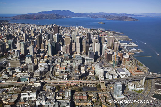
The aerial photography library of Aerial Archives contains a selection of aerial photographs of south of Market Street, San Francisco,(SOMA), California including oblique aerial photographs of the area prior to construction of the Salesforce Tower. This aerial photography collection includes oblique aerial photographs of South of Market street, San Francisco, CA, including aerial views of specific construction projects and construction sites and aerial photographs of individual buildings and unique architecture. To obtain the aerial photograph of construction in the new financial district in San Francisco, south of Market Street, San Francisco from Rincon Hill showing the Bay Bridge off ramp shown above please contact Aerial Archives.
|
|
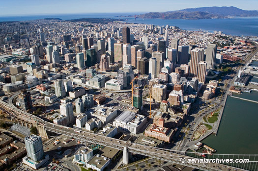
The aerial photograph of the South of Market area, San Francisco, California shown above is available for immediate online license or, to obtain it optimized to your needs please contact Aerial Archives directly and reference the ID number in the caption to the photograph.
The archive also contains a comprehensive collection of vertical aerial photographs of South of Market, San Francisco and aerial maps of South of Market, San Francisco, including aerial photos of the South of Market, San Francisco area both in color and black and white.
To order a specific aerial photograph of South of Market, San Francisco, CA not shown on this site, please use the research request form. Additional information about obtaining existing aerial photography is also available at aerial photography research and at aerial photography research FAQs. |