

Aerial Photographs of Humboldt County For Immediate Download
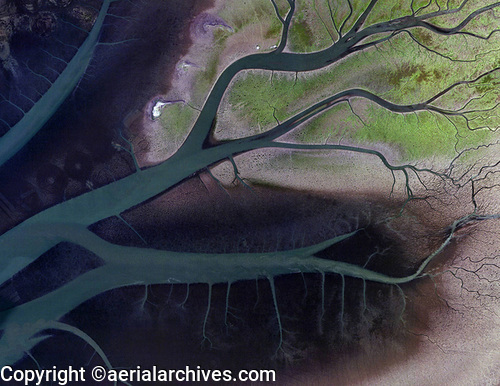
Current and historical aerial maps and satellite imagery of Humboldt county, California are available from Aerial Archives. Available imagery includes high resolution georeferenced aerial photography of Humboldt county and extensive oblique aerial photography of Arcata, Eureka, Fortuna, Trinidad and the Pacific coastline of Humbolt County Aerial Archives provides imagery for the entire county, and aerial photography can be delivered for the whole county in a seamless view or for individual cities and towns. Specialized services include delivery of geotiffs, customized labelling of aerial maps and output to specialized media. The aerial of coverage of aerial maps of Humboldt county can also be completely customized both with respect to scale and to show the entire city or metropolitan area or only a set of blocks. The entire county is available digitally or as prints. The aerial map shown above of tidal channels in Humboldt Bay near Arcata is available for immediate online license or prints or, to obtain a large file or this image optimized to your needs please contact Aerial Archives directly and reference the ID number in the caption to the photograph.
For historical research of aerial photography of Humboldt County we recommend that you use the research request form. Additional information about the process of researching historical aerial photography for your location is available at aerial photography research.
|