

An extensive selection of vertical aerial photography,aerial maps aerial maps and satellite imagery of Merced county, California, including historical and current aerial maps of the cities in Merced as well the agricultural areas and aqueducts and rivers running through Merced county.
Included are in this collection of aerial maps aerial maps and satellite imagery are
Atwater,
Livingston,
Los Banos,
Merced,
Dos Palos,
Gustine,
Ballico,
Cressey,
Delhi,
Hilmar,
Le Grand,
Planada,
Santa Nella,
Snelling,
South Dos Palos,
Stevinson and
Winton.
The aerial map of the City of Merced shown on this page is available for immediate online license or prints.
For current aerial map aerial maps and satellite imagery coverage of Merced county or to request a custom shoot, please contact us. To request historical research of aerial photography and satellite imagery of Merced county please use the research request form.
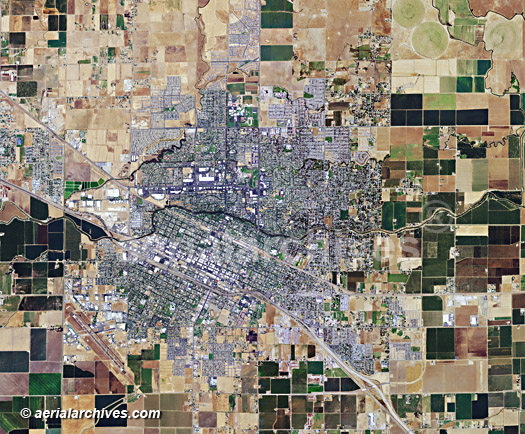
Aerial Map of the City of Merced
Merced County, California
Image ID: AHLV3012
© Herb Lingl/aerialarchives.com
Terms of Image Use |
Immediate License or Prints
Feedback
Aerial photography of the Grasslands Wildlife Management Area
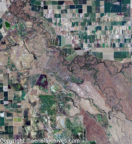
Merced County, California
Image ID: AHLB3013
© Herb Lingl/aerialarchives.com
Terms of Image Use |
Immediate License or Prints
Feedback
The aerial photo map of the Grasslands Wildlife Management Area, Merced County, California shown above is available for immediate online license or prints, or to obtain this image optimized to your specification, please contact Aerial Archives directly.