

Aerial Maps and Photographs of Mono County, California
Mono County California Aerial Photography For Immediate Download

|
An extensive selection of vertical aerial photography and satellite imagery of Mono County, CA, including and historical and current aerial photography of Mono county. Available imagery includes orthorectified aerial photography and satellite imagery of Mono County delivered both as prints and in digital form. Specialized services include delivery of geotiffs, customized labelling of aerial maps and output to specialized media. The aerial of coverage of aerial maps and satellite imagery of Mono County can also be completely customized both with respect to scale and to show an entire city, the complete county or only a set of blocks. Among the communities included in the collection are Benton, Bodie, Bridgeport, Chalfant, Coleville, Lee Vining, Mammoth Lakes and Swall Meadows. The aerial photograph of Bridgeport Lake in Mono County, California shown on this page is available for immediate online license or prints or, to obtain it optimized to your needs or as a higher resolution file please contact Aerial Archives directly and reference the ID number in the caption to the photograph. To request a custom flight to create an aerial map of Mono or for current aerial photography and satellite imagery coverage of Mono county, California please contact us. For historical research of aerial photography and satellite imagery of Mono County, California we recommend that you use the research request form. Additional information about the process of researching historical aerial photography for your location is available at aerial photography research.
|
|
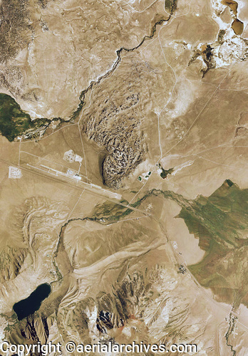
The aerial photograph of Mammoth Lakes, Mono County, California shown on this page is available for immediate online license or prints or, to obtain it optimized to your needs or as a higher resolution file please contact Aerial Archives
directly and reference the ID number in the caption to the photograph.
An extensive selection of vertical aerial photography and satellite imagery of Mono County, CA, including and historical and current aerial photography of Mono county. Available imagery includes orthorectified aerial photography and satellite imagery of Mono County delivered both as prints and in digital form. Specialized services include delivery of geotiffs, customized labelling of aerial maps and output to specialized media. The aerial of coverage of aerial maps and satellite imagery of Mono County can also be completely customized both with respect to scale and to show an entire city, the complete county or only a set of blocks.
|