

High Resolution Aerial Photo Maps of New Jersey
Aerial Photographs of New Jersey For Immediate Download
|
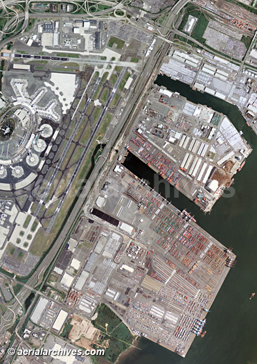
An extensive selection of high resolution vertical aerial photography (aerial maps) of New Jersey, including and historical and current aerial photography is available from Aerial Archives. Available imagery includes georeferenced aerial photography of New Jersey delivered both as prints and in digital form. The aerial of coverage of aerial maps of New Jersey can be completely customized both with respect to scale and to show an entire city or a complete metropolitan area or only a set of blocks. For oblique (at an angle) aerial photographs of New Jersey please consult The aerial map of Newark, New Jersey shown on this page is available for immediate online license or prints or, to obtain it optimized to your needs or as a higher resolution file please contact Aerial Archives directly and reference the ID number in the caption to the photograph.
|
|
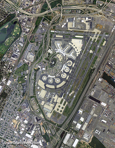
To obtain the aerial photo map of Newark Liberty International Airport, New Jersey shown on this page please contact Aerial Archives
directly and reference the ID number in the caption to the photograph.
|
|
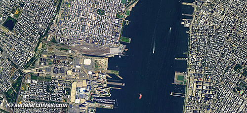
To obtain the aerial photo map of Newport, Jersey City and Hoboken, New Jersey at Holland Tunnel shown on this page please contact Aerial Archives
directly and reference the ID number in the caption to the photograph.
|
|
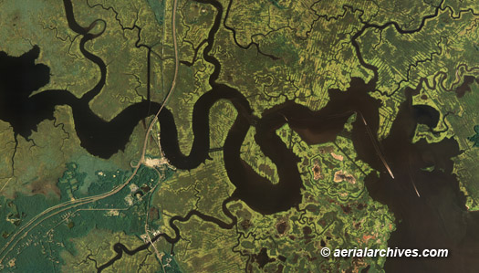
The aerial photo map of wetlands in Burlington county, New Jersey shown on this page is available for immediate online license or, to obtain it optimized to your needs or as a higher resolution file please contact Aerial Archives
directly and reference the ID number in the caption to the photograph. For current aerial photography coverage of New Jersey please contact us. For historical research of aerial photography of New Jersey we recommend that you use the research request form. Additional information about the process of researching historical aerial photography for your location is available at aerial photography research.
|