

Aerial Photo Maps and Satellite Imagery of the City and County of San Diego
Aerial Photographs of San Diego for Immediate Download
An extensive selection of aerial photo maps and and satellite imagery of the City and County of San Diego, CA is available from Aerial Archives. This collection includes and historical and current aerial photography and satellite imagery. Available imagery includes georeferenced aerial photography of the City and County of San Diego delivered both as prints and digital files. Specialized services include delivery of geotiffs, customized labelling of aerial maps and output to specialized media. The aerial of coverage of aerial maps of the City and County of San Diego can also be completely customized both with respect to scale and to show the county or only a specific community. For oblique (at an angle) aerial photography of San Diego please visit aerial photographs of San Diego.
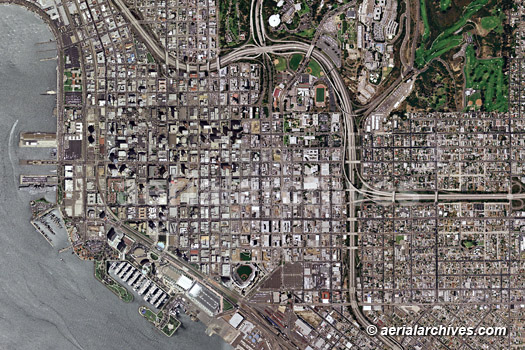
The aerial photo map of San Diego, California shown above is available for immediate online license or prints, or to obtain this image optimized to your specific specifications please contact Aerial Archives directly. San Diego aerial photo map and satellite imagery coverage includes vertical aerial views of Chula Vista, Coronado Del Mar El Cajon Encinitas (Cardiff-by-the-Sea, Leucadia, Olivenhain), Escondido, Imperial Beach, La Mesa, Lemon Grove, National City, Oceanside, Poway, San Diego, San Marcos, Santee, Solana Beach and Vista.
|
Satellite Imagery of the greater San Diego Tijuana metropolitan area
|
Aerial Archives provides both high resolution satellite imagery, and broader overviews for clients. For an examples of satellite resolution, please visit satellite imagery . Aerial Archives will also arrange to task satellites on behalf of clients for custom satellite images. For custom aerial photograph of San Diego or for current aerial photography coverage of the City and County of San Diego, California please contact us.
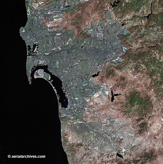
The aerial photo map of San Diego Tijuana Metropolitan Area shown above is available for immediate online license or prints, or to obtain this image optimized to your specific specifications please contact Aerial Archives directly. A selection of h aerial photographs of the San Diego Tijuana border are available at: aerial photographs of Tijuana. A selection of historical aerial photographs of San Diego county are available at: historical aerial photographs of San Diego. For historical research of aerial photography and satellite imagery of the City and County of San Diego, California we recommend that you use the research request form. Additional information about the process of researching historical aerial photography and satellite imagery for your location is available at aerial photography research. |