

Aerials Photographs of Houston Available for Immediate License
|
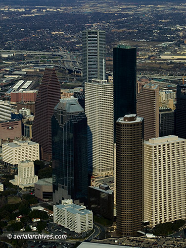
The aerial photography library of Aerial Archives contains an extensive selection of aerial photographs of Houston, Texas. This aerial photography collection includes oblique aerial photographs of Houston, TX, including aerial views of downtown Houston, high rise office towers and corporate headquarters, the surrounding communities and the Port of Houston and Houston ship channel. The collection also includes aerial photographs of the major Houston freeways and other Houston urban and geographical features. To view aerials photographs of Houston available for immediate download or prints, please consult aerial photographs of Houston.The archive also contains a comprehensive collection of current and historical vertical aerial photographs (straight down aerial maps) of Houston, Texas and the surrounding area (see below for details). Aerial Archives also creates custom aerial photography of Houston on assignment. To obtain additional information and ideas for your project, please contact us. The aerial photograph of the tallest Houston skyscrapers and high rise office buildings shown on this page is available for immediate online license or prints or to obtain this image optimized to your specific specifications please contact Aerial Archives directly.
|
Aerial Photographs of Port of Houston and
Houston Ship Channel
|
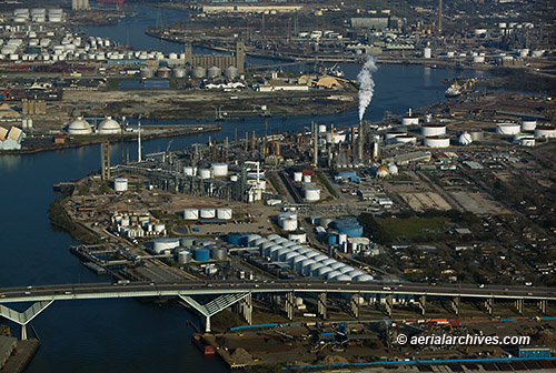
The aerial photograph of the the Shell Deer Park Refinery and Houston Ship Chanel shown above is available for immediate online license or prints or to obtain this image optimized to your specific specifications please contact Aerial Archives directly.
|
|
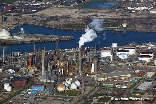
The aerial photograph of the the Shell Deer Park Refinery and Houston Ship Chanel shown above is available for immediate online license or prints or to obtain this image optimized to your specific specifications please contact Aerial Archives directly.
|
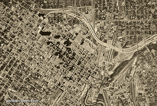
Aerial Maps of Houston, Texas
|
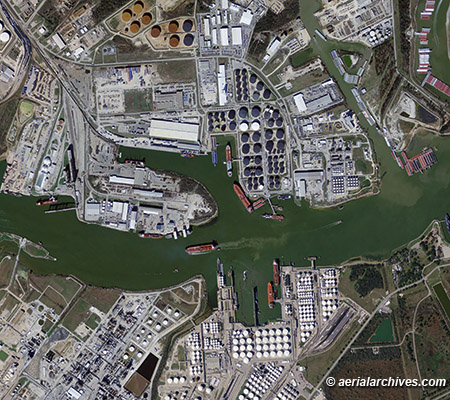
Aerial Archives also provides current and historical aerial maps of Houston and other cities and counties in Texas. The aerial map of Houston, Texas shown above is available for immediate online license or prints or to obtain this image optimized to your specific specifications please contact Aerial Archives directly.
|
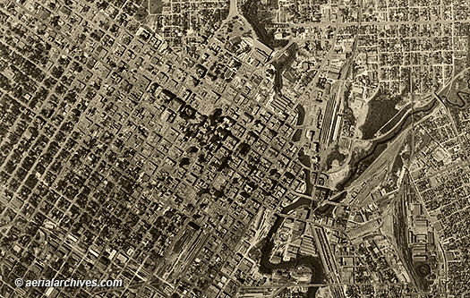
Historical Aerial Photography of Houston, Texas
Historical Aerial Photographs of Houston Available for Immediate License
|
Aerial Archives also provides historical aerial photography of Houston and other cities and counties in Texas. For current vertical aerial photography coverage of Texas please contact us. For historical research of aerial photography of Texas we recommend that you use the research request form. Additional information about the process of researching historical aerial photography for your location is available at HREF="/Aerial-Photography-Research.htm">aerial photography research.
|
|
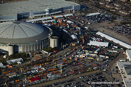
The aerial photograph the Houston Rodeo at the Reliant Stadium shown above is available for immediate online license or prints or to obtain this image optimized to your specific specifications please contact Aerial Archives directly.
|