

Aerial Photographs of Manhattan
New York City
New York City Aerial Photographs For Immediate Download
|
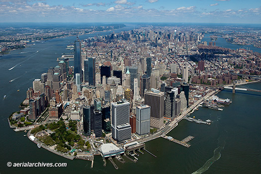
A broad and diverse selection of Manhattan aerial photographs is represented in the library of Aerial Archives. To view aerial photographs of Manhattan available for immediate online license or prints, please consult aerial photographs of Manhattan, New York City. The collection includes views of the Manhattan skyline, major buildings, bridges, harbors and piers and numerous other Manhattan aerials, as well as coverage of Brooklyn, portions of Staaten Island, the Bronx and New Jersey. The archive also contains a comprehensive collection of vertical New York City aerials including both current and historical aerial maps and satellite imagery of Manhattan and the entire New York metropolitan area both in color and black and white and Manhattan aerials in infrared color for an entirely different look. Additional information is available at aerial photo maps of New York. The aerial photograph of Manhattan shown on this page is available for immediate online license or prints. Aerial Archives will also deliver this image optimized to your specific specifications either as a digital file or as a print, aerial mural, transparency or backlit display. To obtain customized service, please contact Aerial Archives directly.
|
Aerial Photographs of the Midtown Manhattan Skyline
|
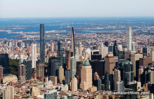
The aerial photograph shown above of midtown Manhattan, New York City as viewed from the Hudson River is available for immediate online license or prints or, to obtain it optimized to your needs please contact Aerial Archives directly and reference the ID number in the caption to the photograph. To review additional aerial photographs of midtown Manhattan please visit midtown Manhattan aerial photographs
|
|
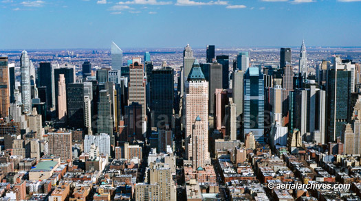
The aerial photograph shown above of midtown Manhattan, New York City as viewed from the Hudson River is available for immediate online license or prints or, to obtain it optimized to your needs please contact Aerial Archives
directly and reference the ID number in the caption to the photograph.
|
The aerial photo map of the Central Park in New York City shown above is available for immediate online license or prints or, to obtain it optimized to your needs please contact Aerial Archives
directly and reference the ID number in the caption to the photograph. A selection of aerial photo maps of is available for immediate online license or prints.
For historical aerial photography please consult historical aerial photography of New York. A selection of historical aerial photographs of New York are available for immediate download or prints.
For historical aerial photography of Manhattan not shown on this site, we recommend that you use the pdf
research request form.
Additional information about obtaining existing aerial photography of Manhattan is also available at
aerial photography research
and at
aerial photography research FAQs.
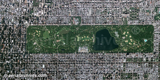
Aerial Photo Map of Central Park
New York City
Image ID: AHLV2034
© aerialarchives.com
Terms of Image Use |
Immediate License or Prints
More Aerial Photographs of Central Park for Immediate Download or Prints
Aerial Archives also delivers both high resolution vertical aerial photography (aerial photo maps) and broad overviews. Additional information is available at aerial photo maps of New York.