

Mendocino County Aerial Photographs For Immediate Download
|
Aerial Archives creates custom aerial photography of Mendocino County, California and its library contains an extensive selection of aerial photographs of Mendocino county in California.
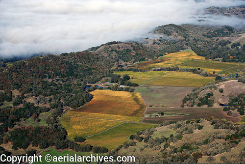
This collection of aerial photography includes oblique aerials of all of Mendocino county including views of each of the major roads, intersections and other features. Among the aerial photographs included in this collection of aerial photography are aerials of Covelo, Fort Bragg, Hopland, Mendocino, Ukiah and Willits.The archive also contains a comprehensive collection of vertical (straight down) aerial photography of Mendocino County. The aerial photograph of coastal vineyards in Mendocino County, shown above is available for immediate online license or prints, or to obtain this image optimized to your specific specifications please contact Aerial Archives directly. For custom aerial photography of Mendocino County or current aerial photography coverage of Mendocino county, California please contact us.
To order historical stock aerial photography of Mendocino County, we recommend that you use the pdf research request form. Additional information about obtaining stock aerial photography is also available at aerial photography research and at aerial photography research FAQs.
|