

Aerials Photographs of Minneapolis Available for Immediate License

Aerial photograph of Minneapolis, Minnesota
Image ID: AHLB3573
© Herb Lingl/aerialarchives.com
Terms of Image Use |
Immediate License or Prints
Feedback
The aerial photography library of Aerial Archives contains a selection of aerial photographs of Minneapolis, Minnesota in Hennepin county.
This aerial photography collection includes oblique aerial photographs of Minneapolis, MN, including aerial views of downtown Minneapolis, the corporate headquarters of the Minnesota Mining and Manufacturing company, 3M, the corporate headquarters of Cargill, the Minneapolis St Paul international World Chamberlain airport (MSP), the surrounding communities including St. Paul, Lake Minnetonka and major geographic features and freeways including the golf courses, parks, hospitals and major downtown streets. Also available are aerial photographs of select buildings in downtown Minneapolis.
Aerial Archives also provides comprehensive current and historical vertical coverage (aerial photo maps) of Minneapolis.
Aerial Photographs of Minneapolis, Minnesota

Aerial photograph of Minneapolis, Minnesota skyline
Viewed from Southeast
Image ID: AHLB3549
© Herb Lingl/aerialarchives.com
Terms of Image Use |
Immediate License or Prints
Feedback
Aerial photography of downtown Minneapolis, Minnesota
The aerial photograph of downtown Minneapolis, MN shown on this page is available for immediate online license or prints or, to obtain it optimized to your needs please contact Aerial Archives
directly and reference the ID number in the caption to the photograph.

Aerial photograph of Minneapolis, Minnesota
and the Mississippi River
Image ID: AHLB3256
© Herb Lingl/aerialarchives.com
Terms of Image Use |
Immediate License or Prints
Feedback
The aerial photograph of downtown Minneapolis, MN shown on this page is available for immediate online license or prints or, to obtain it optimized to your needs please contact Aerial Archives
directly and reference the ID number in the caption to the photograph.
Aerial Photo Maps of Minneapolis, Minnesota
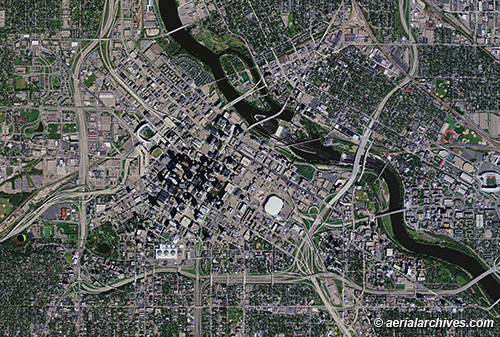
Aerial photo map of Minneapolis, Minnesota, 2010
Image ID: AHLV3355
For a more recent photo map of Minneapolis,
please contact Aerial Archives.
© Herb Lingl/aerialarchives.com
Terms of Image Use |
Immediate License or Prints
Feedback
Aerial Archives also provides comprehensive current and historical vertical coverage (aerial photo maps) of Minneapolis. For additional details please visit
To obtain the aerial photo map of downtown Minneapolis, Minnesota shown on this page please contact Aerial Archives directly and reference the ID number in the caption to the photograph.
Historical Aerial Photography of Minneapolis, Minnesota
Aerial Photo Maps and Satellite Imagery of Minnesota.
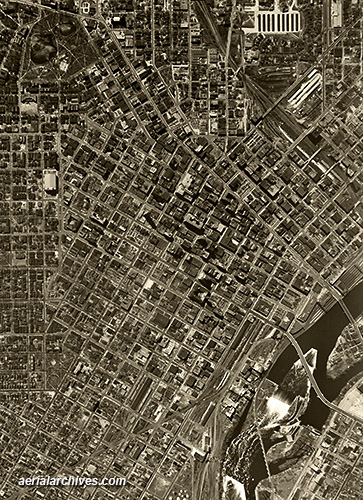
Historical Aerial Photograph of Minneapolis, Minnesota
1947
Image ID: AHLV3354
© Herb Lingl/aerialarchives.com
Terms of Image Use |
Immediate License or Prints
Feedback
Aerial Archives also provides comprehensive historical aerial photography coverage of Minneapolis and other parts of Minnesota.
To obtain the historical aerial photograph of downtown Minneapolis, Minnesota shown on this page please contact Aerial Archives directly and reference the ID number in the caption to the photograph.
To order a specific aerial photograph of Minneapolis, MN not shown on this site, please
contact Aerial Archives directly.
For historical research of aerial photography of Minnesota we recommend that you use the research request form. Additional information about the process of researching historical aerial photography for your location is available at aerial
photography research and at aerial photography research FAQs.