Aerial Archives - Aerial Photographs

Aerial Photographs of Phoenix, Arizona

Phoenix Aerial Photographs For Immediate Download

© aerialarchives.com  aerial downtown Phoenix Arizona
AHLE0136
Aerial photograph of Downtown
Phoenix, Arizona;
Image ID: AHLE0136
© Herb Lingl/aerialarchives.com
Terms of Image Use | Immediate License or Prints
Feedback

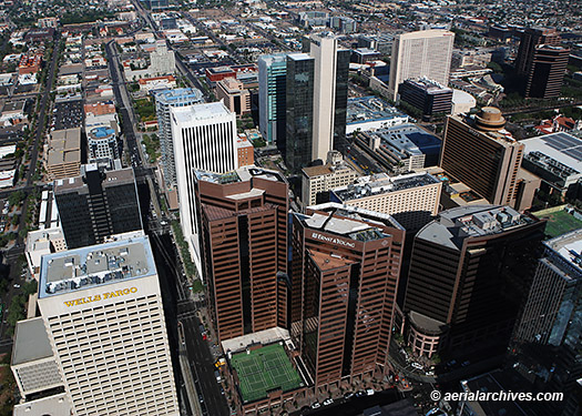
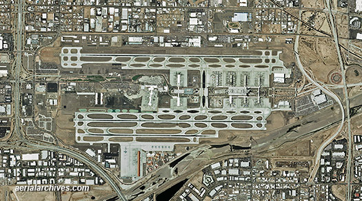
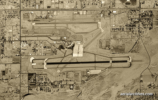
An extensive selection of high resolution aerial photographs and satellite imagery of Phoenix, Arizona is available from Aerial Archives.

This includes oblique aerial photographs of Phoenix including aerial views of downtown Phoenix and the Phoenix Sky Harbor International airport, and the major freeways, buildings and geographic features.

The areas to the south, west and north of Phoenix are also covered by this collection, including Casa Grande, Arizona Firebird Lake, Squaw Peak, Lake Pleasant, the Quintero Golf Course, the Glendale airport, the Phoenix Goodyear airport, and Buckeye, Arizona.

Also included are numerous aerial photographs of the freeway corridors of interstate 10, I-10, aerial photographs of the major freeway and highway interchanges.

To view additional aerial photographs of Phoenix please visit Phoenix aerial photographs.

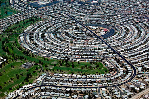
Aerial Photographs of Residential Phoenix, Arizona

© aerialarchives.com  aerial Phoenix Arizona surban residential circular housing tract
AHLB4058
Aerial photograph suburban residential circular housing tract
Phoenix, Arizona;
Image ID: AHLB4278
© Herb Lingl/aerialarchives.com
Terms of Image Use | Immediate License or Prints
Feedback

An extensive selection aerial photographs and satellite imagery of Phoenix, Arizona is available from Aerial Archives.

Current Aerial Photo Maps and Satellite Imagery of Phoenix, Arizona

graphics © aerialarchives.com, aerial photo Phoenix Sky Harbor Airport,
AHLV3108
Aerial Photograph Map
Phoenix Sky Harbor Airport
Phoenix, Arizona
Image ID: AHLV3108
© aerialarchives.com
Terms of Image Use | Immediate License or Prints
Feedback

In addition to oblique aerial photography of Phoenix, comprehensive color vertical aerial photography coverage and satellite imagery of the entire Phoenix, Arizona metropolitan area is available. Satellite imagery is often the most recent imagery available since it is acquired more frequently than aerial photography. Satellite imagery is also available for any other portion of Arizona.

To obtain current vertical coverage or customized service, please contact Aerial Archives directly.

Historical Aerial Photographs of Phoenix, Arizona

graphics © aerialarchives.com,  historical aerial photo Phoenix Sky Harbor Airport,
AHLV3523
Historical Aerial Photograph
Phoenix Sky Harbor Airport
Phoenix, Arizona
1961
Image ID: AHLV3532
© aerialarchives.com
Terms of Image Use | Immediate License or Prints
Feedback

Aerial Archives provides in depth historical aerial photography and satellite coverage of Phoenix and all other areas in Arizona.

To request research of a specific historical aerial photography of Phoenix, Arizona not shown on this site, please use the pdf research request form.

Additional information about obtaining historical aerial photography is also available at aerial photography research and at aerial photography research FAQs.

Copyright by Aerial Archives