

Aerial Photographs of Santa Cruz County for Immediate Download
|
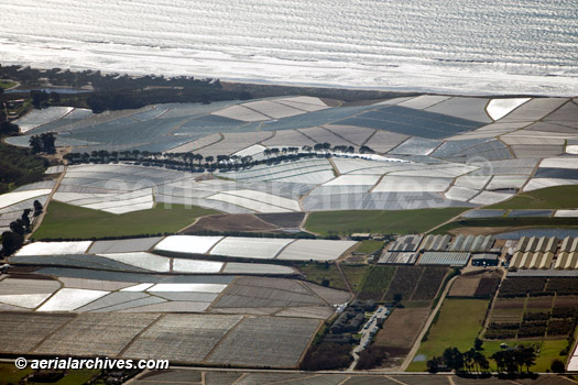
Aerial Archives creates custom aerial photography of Santa Cruz county, California and its library contains an extensive selection of aerial photographs and aerial maps of Santa Cruz county. The archive also contains a comprehensive collection of vertical Santa Cruz County aerials including aerial photographs and aerial maps of Santa Cruz County both in color and black and white. Addition al information is available at aerial maps of Santa Cruz county. The aerial photograph of farming in Watsonville, California along the Pacific coastline in Santa Cruz county shown above is available for immediate online license or print, or to obtain this image optimized to your specific specifications please contact Aerial Archives directly. For a custom flight of a location in Santa Cruz county of for specific requests for Santa Cruz County aerial photos and other portions of greater San Francisco Bay Area please contact Aerial Archives directly.
|