

Aerial Photographs Mining for Immediate Download
|
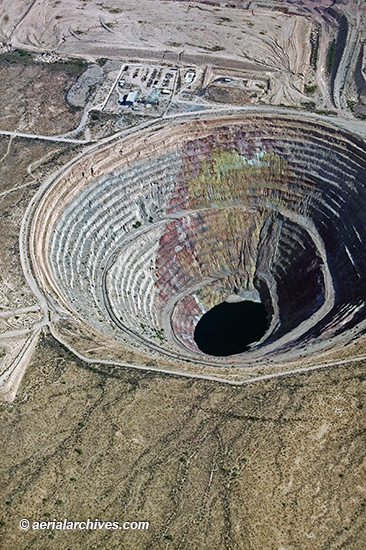
Aerial Archives archive of aerial photography includes many aerial photographs of mines and mining. Included in the collection are aerial photographs of many quarries, former mercury mines, lava mines and salt facilities and historical vertical aerial coverage of most mining facilities in the United States. A selection of aerial photographs of mines are available for immediate download or prints at aerial photographs of mines. The aerial photograph of the abandoned copper mine shown above is available for immediate online license or prints, or to obtain this image optimized to your specific specifications please contact Aerial Archives directly.
|
|
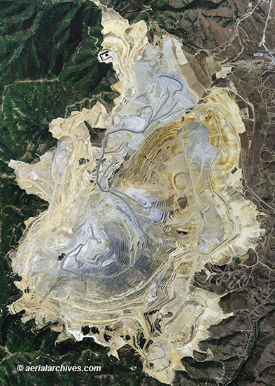
Aerial maps, vertical aerial photography and satellite photographs of mines around the world are available from Aerial Archives. For an aerial photograph or aerial map of a mine or mining region not shown on this site please contact us directly. For historical research of aerial photography and aerial maps and satellite photography of mines, we recommend that you use the research request form. Additional information about the process of researching historical aerial photography for your location is available at aerial photography research. The aerial photo map of the Bingham Canyon Mine shown above is available for immediate online license or prints, or to obtain this image optimized to your specific specifications please contact Aerial Archives directly. More aerial photos of the Bingham Canyon Mine are available at aerial photos of the Bingham Canyon Mine. |