

Aerial Photographs of Shipping Ports and Harbors
Browse Aerial Photographs of Ports
|
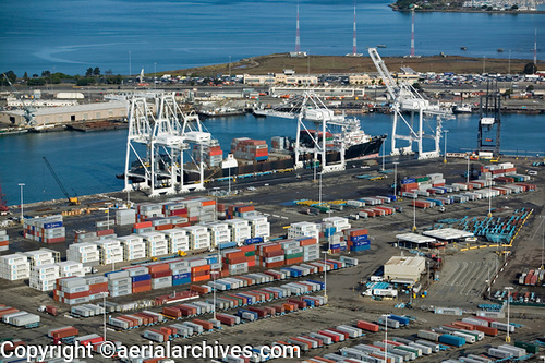
One of the specialties of Aerial Archives is the creation of detailed aerial images of maritime subjects around the world, including ports and harbors. The aerial photography archives of Aerial Archives contain a collection of aerial photography and aerial maps which includes many ports. Current vertical aerial photography of most ports in the United States is available from Aerial Archives as is historical aerial photography of ports both still in service and no longer in being used as major transportation hubs. In addition oblique aerial photography of many ports and harbors around the world is available from Aerial Archives. Ports and harbors which are covered by Aerial Archives oblique aerial photography collection include: the Port of Baton Rouge, Cape Canaveral, the Port of Hong Kong and Hong Kong harbor, the Port of Miami the Port of New Orleans, Port Newark Container Terminal the Port of Oakland, the Port of Long Beach, the Port of Los Angeles, the Port of Redwood City, the Port of Richmond, the Port of San Francisco, the Port of Stockton, the Port of Sacramento, the San Diego harbor the Port of Tampa the Port of Veracruz, Mexico. The aerial photograph of a Maersk containership being unloaded at the Maersk Sealand Terminal, Outer Harbor, Port of Oakland, CA, shown on this page is available for immediate online license or prints or, to obtain it optimized to your needs please contact Aerial Archives directly and reference the ID number in the caption to the photograph.
|
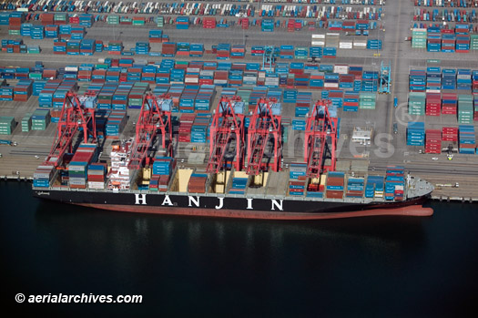
Aerial Photographs of Ports of Long Beach and Los Angeles
|
The aerial photograph of a Hanjin containership being unloaded at
|
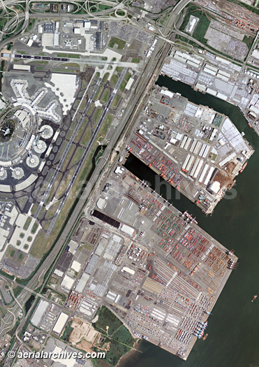
Aerial Maps of Ports and Harbors
|
Also available are aerial maps and satellite photographs of all of the major ports and harbors around the world. The aerial map of the Port of Newark New Jersey shown on this page is available for immediate online license or prints or, to obtain it optimized to your needs please contact Aerial Archives directly and reference the ID number in the caption to the photograph. For custom aerial photogrphy of a port, harbor or an arriving or departing vessel, or to obtain an aerial photograph or map not shown on this site please contact Aerial Archives. To obtain historical aerial photographs of ports or harbors please consult aerial photography research and aerial photography research FAQs. |