

Aerial Photographs of San Diego, California
San Diego Aerial Photography For Immediate Download
|
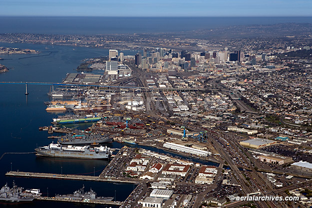
Aerial Archives creates custom aerial photography of San Diego, California and its library contains an extensive selection of current and historical aerial photographs of San Diego, California. To view thumbnails of aerial photographs of San Diego available for immediate online license or prints, please consult San Diego aerials photographs. This aerial photography collection includes oblique aerial photographs of San Diego, California, including aerial photography of downtown San Diego, individual corporate headquarters, the San Diego International Airport, Lindbergh Field (SAN), the surrounding communities including La Jolla. Also available are numerous aerial photographs of the individual buildings in downtown San Diego and extensive aerial photography of the San Diego harbor. The collection also includes aerial photographs of a Petco Stadium in San Diego, San Diego Coronado bridge, the major San Diego freeways and other urban and geographical features of San Diego and the border crossing at San Ysidro. Aerial Archives also delivers vertical aerial photographs of San Diego and aerial maps of San Diego and the surrounding area as well as historical aerial photography of San Diego. The aerial photograph of the southern piers of San Diego, California looking toward the San Diego harbor and city center shown above is available for immediate online license or prints or, to obtain it optimized to your needs please contact Aerial Archives directly and reference the ID number in the caption to the photograph.
|
Aerial Photography Downtown San Diego
The aerial photograph of One America Plaza in San Diego, California shown on this page is available for immediate online license or prints or, to obtain it optimized to your needs please contact Aerial Archives
directly and reference the ID number in the caption to the photograph.
The aerial photograph of the USS Midway aircraft carrier
and San Diego naval aviation museum in San Diego, California shown on this page is available for immediate online license or prints or, to obtain it optimized to your needs please contact Aerial Archives
directly and reference the ID number in the caption to the photograph.
The aerial photograph of the Coronado Bridge in San Diego, California shown on this page is available for immediate online license or prints or, to obtain it optimized to your needs please contact Aerial Archives
directly and reference the ID number in the caption to the photograph.
The aerial photograph of Petco Park open air ballpark San Diego, California shown on this page is available for immediate online license or prints or, to obtain it optimized to your needs please contact Aerial Archives
directly and reference the ID number in the caption to the photograph.
The aerial photograph of the General Dynamics NASSCO ship construction yard, San Diego, California shown on this page is available for immediate online license or prints or, to obtain it optimized to your needs please contact Aerial Archives
directly and reference the ID number in the caption to the photograph.
For aerial maps or vertical aerial photography, please consult aerial maps of San Diego.
For custom aerial photography of San Diego or to obtain a specific aerial photograph of San Diego, CA not shown on this site, please
contact us.
Also available is historical aerial photography of San Diego. Additional information is available at historical aerial photography of San Diego.
For historical aerial photography we recommend that you use the
research request form.
Additional information about obtaining existing aerial photography is also available at
aerial photography research
and at
aerial photography research FAQs.
Aerial photograph downtown San Diego, California
Image ID: AHLB4689
© Herb Lingl/aerialarchives.com
Terms of Image Use |
Immediate License or Prints
Feedback
Aerial Photograph of One America Plaza, San Diego, California
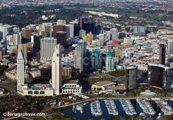
The aerial photograph of downtown San Diego, CA
is available for immediate online license or prints or, to obtain it optimized to your needs please contact Aerial Archives
directly and reference the ID number in the caption to the photograph. 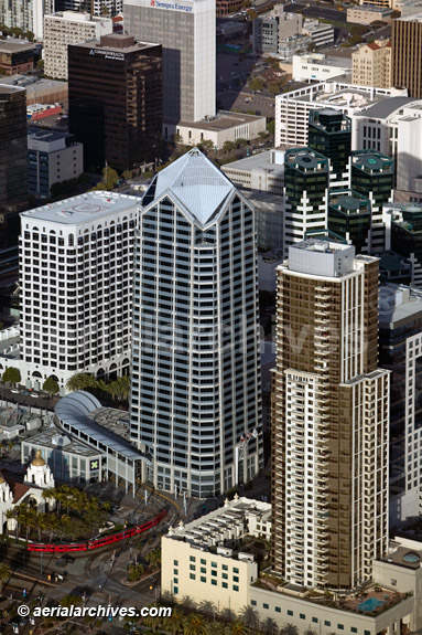
Aerial photograph of One America Plaza, 600 West Broadway
designed by Murphy/Jahn Architects and KMA Architecture
Office tower base features a glass enclosed trolley station
Adjacent towers include Sempra Energy building, Commonwealth Financial
San Diego, California
Image ID: AHLB4687
© Herb Lingl/aerialarchives.com
Terms of Image Use |
Immediate License or Prints
Feedback
Aerial Photograph Aircraft Carrier Midway and Downtown San Diego
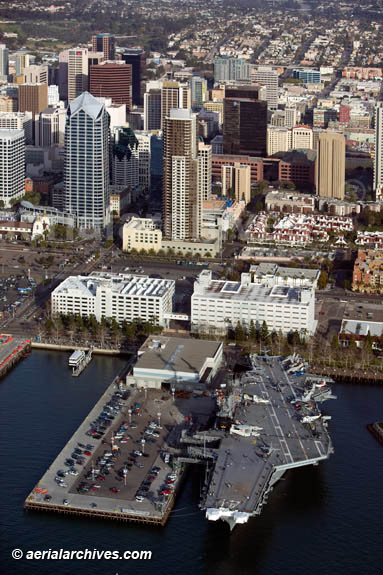
Aerial photograph USS Midway aircraft carrier
San Diego Naval Aviation Museum
San Diego, California
Image ID: AHLB4559
© Herb Lingl/aerialarchives.com
Terms of Image Use |
Immediate License or Prints
Feedback
Aerial Photographs of Coronado Bridge, San Diego
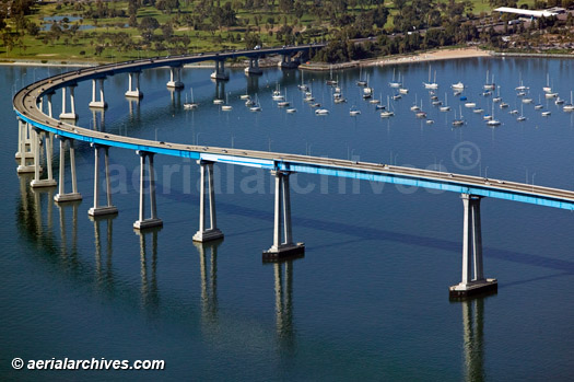
Aerial photograph of Coronado Bridge
San Diego, California
Image ID: AHLB4682
© Herb Lingl/aerialarchives.com
Terms of Image Use |
Immediate License or Prints
Feedback
Aerial Photographs of Petco Park open air ballpark San Diego
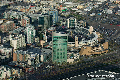
Aerial photograph of Petco Park open air Ballpark
San Diego, California
Image ID: AHLB6901
© Herb Lingl/aerialarchives.com
Terms of Image Use |
Immediate License or Prints
Feedback
Aerial Photographs of General Dynamics NASSCO ship construction yard, San Diego
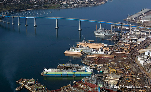
Aerial photograph of General Dynamics NASSCO ship construction yard
Port of San Diego and Coronado Bridge
San Diego, California
Image ID: AHLB7849
© Herb Lingl/aerialarchives.com
Terms of Image Use |
Immediate License or Prints
Feedback