

San Diego Historical Aerial Photography For Immediate Download
|
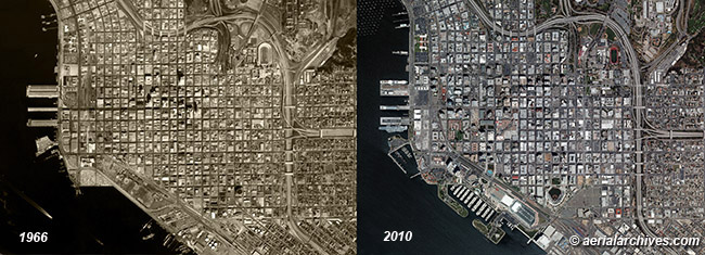
An extensive selection of high resolution historical aerial photography of San Diego and San Diego County California is available from Aerial Archives. Historical aerial photographs are available for advertising and editorial use as well as for use to establish facts about historical conditions by law firms, investigators, and researchers conducting due diligence. Aerial Archives also provides current aerial photographs which can be used to make a then and now comparision with the historical aerial photography. The historical and current aerial photography comparision of San Diego, California shown above is available for immediate online license or prints or, to obtain it optimized to your needs please contact Aerial Archives directly and reference the ID number in the caption to the photograph. contact Aerial Archives directly and reference the ID number in the caption to the photograph. More detailed views of the historical and current aerial perspectives are shown below. |
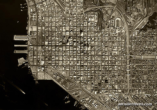
Historical Aerial Photography of San Diego, California 1966
|
A more detailed view of downtown San Diego in 1966. The historical aerial photograph of San Diego, California shown above is available for immediate online license or prints or, to obtain it optimized to your needs please contact Aerial Archives directly and reference the ID number in the caption to the photograph. contact Aerial Archives directly and reference the ID number in the caption to the photograph.
|
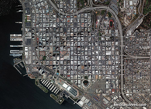
Aerial Photography of San Diego, 2010
|
An extensive selection of high resolution vertical aerial photography (aerial photo maps) of San Diego and San Diego County, California is available from Aerial Archives. For additional information, please consult aerial photo maps of San Diego. Oblique (at an angle) aerial photography is also available. Additional details are available at oblique aerial photography of San Diego. The historical aerial photograph of San Diego, California shown above is available for immediate online license or prints or, to obtain it optimized to your needs please contact Aerial Archives directly and reference the ID number in the caption to the photograph. contact Aerial Archives directly and reference the ID number in the caption to the photograph.
|
|
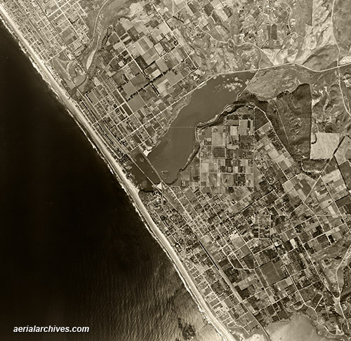
The historical aerial photograph of Carlsbad, California shown above is available for
immediate online license or prints or, to obtain it optimized to your needs please contact Aerial Archives directly and reference the ID number in the caption to the photograph.
|
|
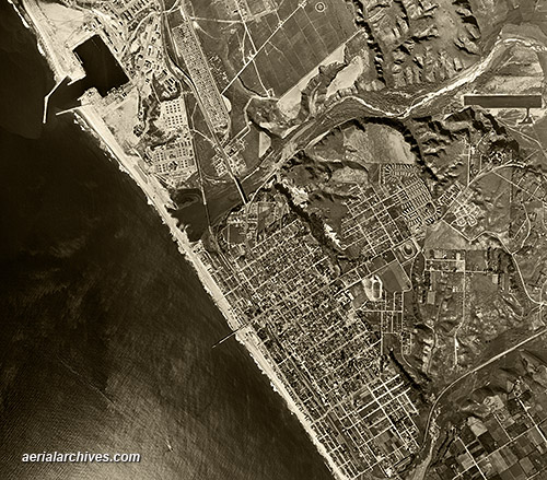
The historical aerial photograph of Oceanside, California shown above is available for
immediate online license or prints or, to obtain it optimized to your needs please contact Aerial Archives directly and reference the ID number in the caption to the photograph. Aerial Archives provides research services for historical aerial photographs and can usually locate an useful historical aerial photograph for clients. For historical research of aerial photography of San Diego, we recommend that you use the pdf research request form. Additional information about the process of researching historical aerial photography for your location is available at aerial photography research.
|