

Historical Aerial Photography of California
Español
Historical Aerial Photography of California For Immediate Download
|
An extensive selection of high resolution historical aerial photography of California is available from Aerial Archives. Historical aerial photographs are available for advertising and editorial use as well as for use to establish facts about historical conditions by law firms, investigators, and researchers conducting due diligence. To view a selection of California historical aerials which are available for immediate download or to order prints online please visit historical aerial photographs of California. Additional quick links are:
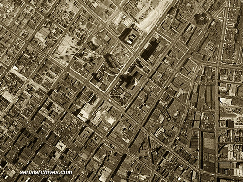
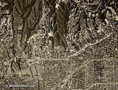
Los Angeles historical aerial photographs Aerial Archives also provides current aerial photographs which can be used to make a then and now comparision with the historical aerial photography. Particularly indepth coverage is available for Los Angeles, Orange County, San Diego county and the San Francisco Bay Area. In addition to historical aerial photography of California, Aerial Archives provides current aerial maps and satellite for any portion of the California. For additional details, please consult aerial maps of California. The historical aerial photograph of downtown Los Angeles, California shown above is available for immediate license or prints.
|
|
High resolution historical aerial photographs of all of Los Angeles county are available from Aerial Archives as are current aerial maps of Los Angeles.
To view a selection of Los Angeles historical aerials available for immediate download or prints please visit historical aerial photographs of Los Angeles. For indepth research services please contact Aerial Archives.
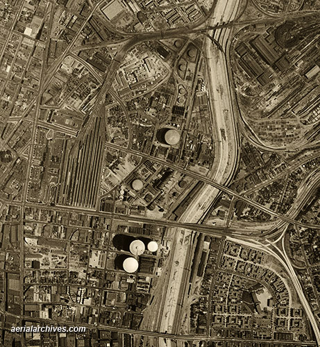
The historical aerial photograph of Los Angeles, California infrastructure shown above is available for immediate license or prints.
|
Historical Aerial Photographs of Orange County
|
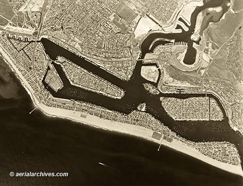
Complete historical aerial photography coverage of all of Orange county, California is available from numerous years, including extensive infrared and color aerial photography coverage. To view a selection of Orange county historical aerials available for immediate download or to order prints online please visit historical aerial photographs of Orange County. The historical aerial photograph of Newport Beach, California shown above is available for immediate license or prints.
|
Historical Aerial Photographs of San Diego County
|
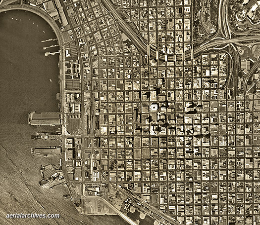
Aerial Archives provides current and historical aerial photography of all of San Diego county. For a selection of historical aerial photographs available for immediate license or prints, please visit historical aerial photographs of San Diego County. The historical aerial photograph of San Diego, California shown above please is available for immediate license or prints.
|
Historical Aerial Photographs of Beverly Hills, California
|
The historical aerial photograph of Beverly Hills, California shown above is available for immediate online license or prints, or to obtain this image optimized to your specifications, please contact Aerial Archives directly.
Aerial Archives provides research services for historical aerial photographs and can usually locate an useful historical aerial photograph for clients. For historical research of aerial photography of California, we recommend that you use the pdf research request form. Additional information about the process of researching historical aerial photography for your location is available at aerial photography research.
|