

|
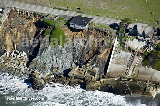
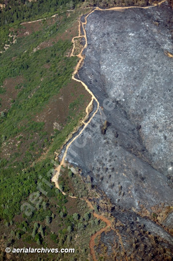
Aerial Archives collection of aerial photography of the environment and environmental issues includes a diverse selection of aerial photographs from California, Mexico, Florida, Mississippi and Japan covering a broad range of environmental issues. Included in the collection are aerial photographs of air pollution, clear cutting, dairy discharges, deforestation, erosion, invasive species, light pollution, plancton blooms, red tides, sediment flows, super fund sites, urban sprawl, water pollution and wetland restoration. Large areas of forests, farmlands, wetlands, bays, estuaries, national parks and other environmentally sensitive areas are also included in the collection, including seamless continguous georeferenced aerial views and aerial maps of large environmentally sensitive regions, and historical aerial photography of such environmentally important areas. The collection also includes infrared aerial photography of various environmental subjects, including the Sacramento river delta. The aerial photograph of erosion of the Sonoma County Pacific coastline shown above is available for immediate online license or prints, or to obtain this image optimized to your specification, please contact Aerial Archives directly.
|
|
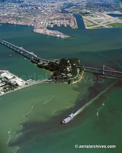
The Aerial Archives library contains numerous aerial photographs of environmental issues relating to water quality. The aerial photograph of the phytoplankton bloom in San Francisco bay shown above is available for immediate online license or prints, or to obtain this image optimized to your specification, please contact Aerial Archives directly.
|
|
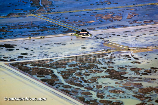
The Aerial Archives library contains numerous aerial photographs of the environmental impacts of flooding with a particular strength in the documentation of flooding in California. To view additional aerial photography of environmental issues relating to flooding, please visit aerial photography of flooding The aerial photograph of flooding in the Sacramento river delta shown above is available for immediate online license or prints, or to obtain this image optimized to your specification, please contact Aerial Archives directly.
|
|
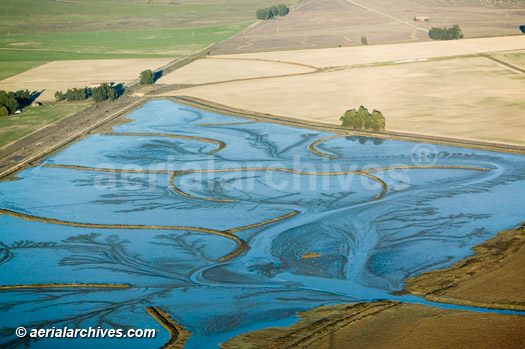
The Aerial Archives library contains numerous aerial photographs of wetland restoration projects with a particular strength in wetland restoration projects in the San Francisco bay area. These efforts have had a major impact on the environmental quality in the San Francisco bay area The aerial photograph of the the Sonoma Baylands wetland restoration project a shown above is available for immediate online license or prints, or to obtain this image optimized to your specification, please contact Aerial Archives directly.
|

|
Aerial Archives documents environmental issues resulting from oil spills.
The archive also contains extensive coverage of petroleum related facilities in numerous locations. Additional information and aerial photographs are available at aerial photography of the petroleum industry
The aerial photograph of a petroleum sheen in San Francisco bay apparantly originating from the junk yard at the top left of the aerial photograph shown above is available for license from Aerial Archives. To obtain this image optimized to your specification, please contact Aerial Archives with the image id.
|
|
Aerial Archives documents environmental issues resulting natural and human induced fires. Additional information and aerial photographs are available at aerial photography of the fires and burn areas
The aerial photograph of Geysers fire in Sonoma County California shown above is available for immediate online license or prints, or to obtain this image optimized to your specification, please contact Aerial Archives directly.
|
|
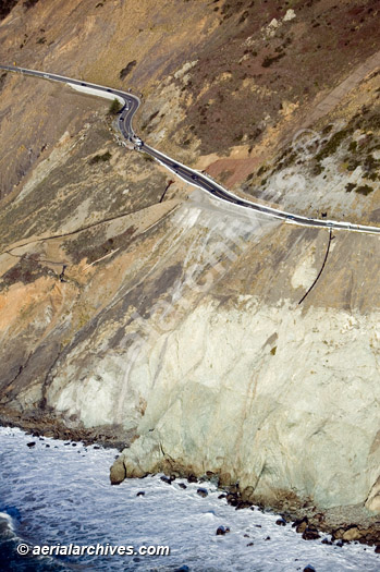
Among the environmental issues documented in the aerial library are landslides and the efforts to contain slides. The aerial photograph of Devil's Slide, the recurring landslide that shuts down Highway One in San Mateo County south of San Francisco and north of Half Moon Bay shown above is available for immediate online license or prints, or to obtain this image optimized to your specification, please contact Aerial Archives directly.
|
|
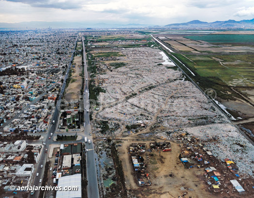
Aerial Archives library also contains extensive coverage of the environmental issues related to waste disposal including water treatment plants and landfills. The aerial photograph shown above of the largest landfill in Mexico City is available for license for reproduction use on web sites, in books, magazines, brochures and other printed, electronic and broadcast media. Aerial Archives will also deliver this image optimized to your specific specifications either as a digital file on CD, DVD or via the internet, or, as a print, aerial mural, transparency or backlit display. To license this image, please contact Aerial Archives and reference the ID number in the caption to the photograph.
To obtain a specific stock aerial photograph of environmental issues not shown on this site, please use the pdf research request form. Additional information about obtaining stock aerial photography is also available at aerial photography research and at aerial photography research FAQs. |