

Aerial Photo Maps of Florida for Immediate Download
and
Aerial Photographs of Florida County For Immediate Download
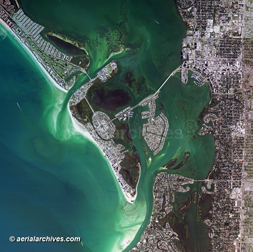
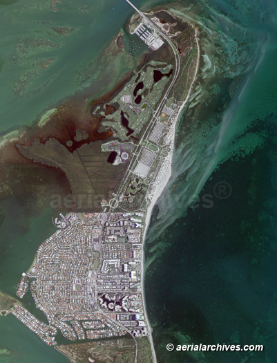
An extensive selection of aerial photography,satellite imagery and aerial maps of Florida is available from Aerial Archives. Available imagery includes georeferenced aerial and satellite photography of Florida delivered both as prints and digital files. Specialized services include high resolution aerial and satellite photography and delivery of geotiffs, customized labelling of aerial maps and output to specialized media. The coverage of aerial maps of Florida can also be completely customized to show an entire city or metropolitan area or only a set of blocks, or if necessary, a large portion of of the state of Florida. The aerial map of the Sarasota Bay, the beaches, Gulf coast and city of Sarasota, Florida shown above is available for immediate online license or print or, to obtain it optimized to your needs please contact Aerial Archives directly and reference the ID number in the caption to the photograph.
|
Aerial Maps of Florida Metropolitan Market Areas
|
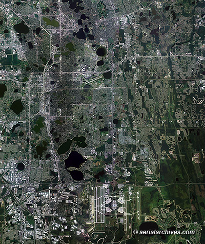
Also available are customized aerial maps of any Florida market area, including all of the major metropolitan market areas. When aerial photography is not recent enough for a particular market area map, Aerial Archives also provides very recent market area maps created from high resolution satellite imagery. |
|
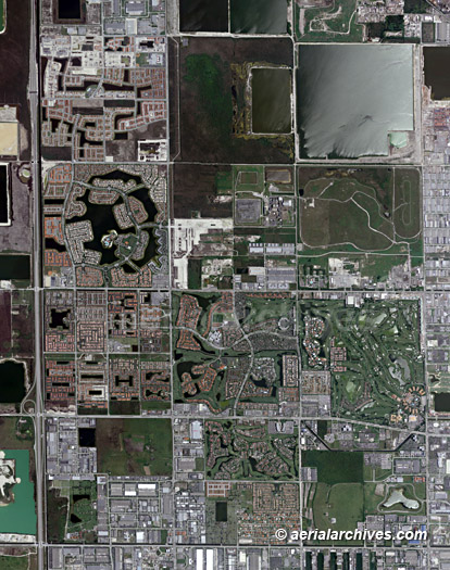
Also available are aerial maps of Florida's cities, suburbs and smaller towns. For oblique (at an angle) aerial photographs of Miami or Orlando and Tampa, please consult Aerial Photographs of Miami, Aerial Photographs of Orlando and Aerial Photographs of the Tampa. The aerial map of the developnment grid in northern Miami shown above is available for immediate online license or prints or, to obtain it optimized to your needs please contact Aerial Archives directly and reference the ID number in the caption to the photograph.
|
|
Also available are aerial maps of Florida's national and state parks, wilderness areas and wildlife preserves.
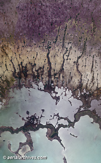
For oblique (at an angle) aerial photography of the Everglades, please visit The aerial map of a portion of the Everglades shown above is available for immediate online license or prints or, to obtain it optimized to your needs please contact Aerial Archives directly and reference the ID number in the caption to the photograph.
|
|
To obtain the aerial photo map of Bill Baggs Cape Florida State Park, Key Biscayne, Florida shown above is available for immediate online license or prints or, to obtain it optimized to your needs please contact Aerial Archives directly and reference the ID number in the caption to the photograph. For current vertical aerial photography coverage of Florida please contact us. For details about historical aerial photography of Florida please consult historical aerial photographs of Florida. For historical research of aerial photography of Florida we recommend that you use the research request form. Additional information about the process of researching historical aerial photography for your location is available at aerial photography research.
|