

Aerial Photo Maps of New York
Aerials Photo Maps of New York Available for Immediate License
|
Aerial Archives maintains an extensive library of aerial photo maps (vertical aerial photography) of New York City and New York State including historical and current aerial photography. Available imagery includes georeferenced aerial photography of New York delivered both as prints and in digital form. Specialized services include delivery of geotiffs, customized labelling of aerial maps and output to specialized media. The aerial of coverage of aerial maps of New York can also be completely customized both with respect to scale and to show the entire city or metropolitan area or only a set of blocks.
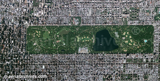
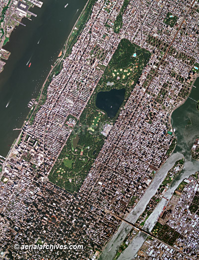
The aerial photo map of the Central Park in New York City shown above is available for immediate online license or prints or, to obtain it optimized to your needs please contact Aerial Archives directly and reference the ID number in the caption to the photograph. For additional aerial photographs of Central Park in New York City please visit aerial photographs of Central Park.
|
|
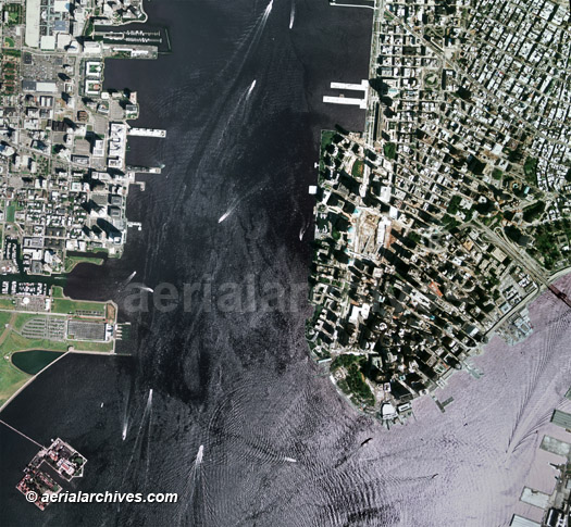
Aerial photo maps are available for the entire island including any portion of the Hudson, East River or Harlem River waterfront areas. The aerial map of the New York Hudson River waterfront shown above is available for immediate online license or prints or, to obtain it optimized to your needs please contact Aerial Archives directly and reference the ID number in the caption to the photograph.
|
|
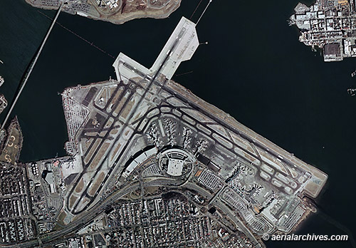
Aerial photo maps are available for all of the New York airports. For additional aerial photographs of New York airports available for immediate license or prints please visit aerial photographs of New York airports. For additional aerial photo maps of other airports available for immediate license or prints please visit more aerial photo maps of airports. The aerial map of the LaGuardia International Airport shown above is available for immediate online license or prints or, to obtain it optimized to your needs please contact Aerial Archives directly and reference the ID number in the caption to the photograph.
|
|
The aerial photo map of the New York harbor shown above is available for immediate online license or prints or, to obtain it optimized to your needs please contact Aerial Archives directly and reference the ID number in the caption to the photograph.
|
|
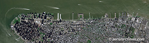
The aerial photo map of the Manhattan shown above is available for immediate online license or prints or, to obtain it optimized to your needs please contact Aerial Archives directly and reference the ID number in the caption to the photograph. For current aerial photography coverage of New York City or other portions of New York State please contact us. For historical aerial photography of New York, please consult historical aerial photographs of New York. For research of historical aerial photography of New York City or other portions of New York State not shown on this site, we recommend that you use the research request form. Additional information about the process of researching historical aerial photography for your location is available at aerial photography research. For oblique aerial photography of New York city, please visit aerial photographs of New York. A related page that may be of interest is aerial maps of New Jersey.
|