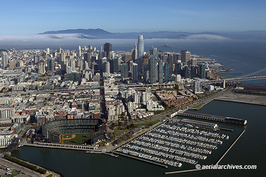
 This aerial photograph the San Francisco financial district skyline shows the Giants Stadium and South Beach Marina in the foreground. Currently known as Oracle Park, the stadium has been renamed numerous times. During its opening in 2001 it was called Pacific Bell Park, then, in 2003, SBC Park and in 2006 AT&T Park. To the right of the stadium is the South Beach Harbor Marina. Visible in this aerial photograph of the San Francisco skyline are many of San Francisco’s high rises including the Salesforce Tower which was completed in 2018, The Transamerica Pyramid, 555 California (the Bank of America Tower), 345 California Center, One Rincon Hill, the Spear Street towers and numerous other high rises. In the background a layer of fog is moving in through the Golden Gate, and behind it the Marin Headlands. Alcatraz island is visible under the fog to the right of the Salesforce Tower.
Image ID: AHLE0364
© Herb Lingl/aerialarchives.com
License this photograph or purchase a print.
More aerial photography of San Francisco skylines.
Detailed aerial photographs of San Francisco skyscrapers.
