Aerial Photographs of Drought at California’s Clear Lake
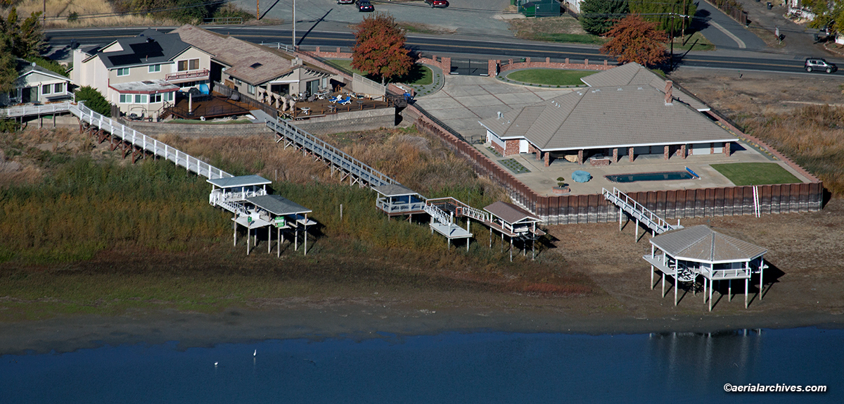
Image ID: AHLE1726
Aerial photographs of the drought at California’s Clear Lake show the lake at historically low levels. Many residential piers around Clear Lake are now far from the water’s edge. Particularly impacted are areas where Clear Lake has a relatively shallow depth drop off. The residential piers in the photograph above are an example of the numerous piers in North Lakeport that are similarly impacted by Clear Lake’s low water level. There are similar high and dry piers in Lakeport, Lower Lake, Clearlake and other locations around the Lake with shallow shorelines.
Numerous residential developments with channels designed to provide access to Clear Lake such as Lakeport Lagoons are completely dry, some overgrown with weeds.

Image ID: AHLE1730
The Rumsey Gage reading indicates the water level of Clear Lake. Zero Rumsey equals 1318.257′ above mean sea level, the normal low level of Clear Lake. Cache Creek Dam controls the level of Clear Lake. The Yolo Water and Power Company built the dam on the south fork of Cache Creek in 1914. The Yolo County Flood Control and Water Conservation District now owns and operates Cache Creek Dam. Yolo County has rights to water in Clear Lake covered by several decrees one of which stipulates that Clear Lake’s water level shall be maintained between zero and 7.56′ above Rumsey. If Clear Lake is “full” on May 1, defined as 7.56′ above Rumsey, Yolo County may withdraw up to 150,000 acre feet of water. If Clear Lake is 3.22′ above Rumsey or lower on May 1, Yolo may not withdraw water from the Lake.
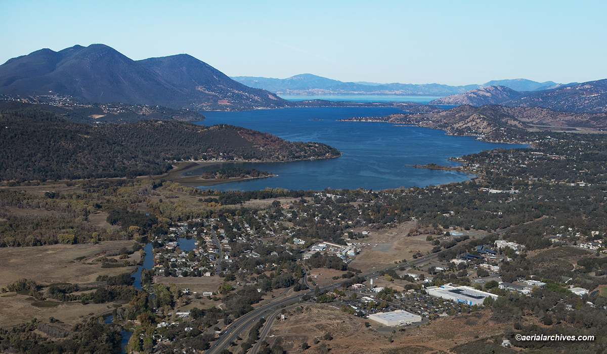
Image ID: AHLE1731
When Clear Lake is full it has a surface area of 43,790 acres and contains 1,155,000 acre-feet of water. When the Lake is at Zero Rumsey it has a surface area of 39,170 acres and contains 842,000 acre-feet of water. As of November 6, 2022, the Lake is at less than 2.6′ below Rumsey.
Clear Lake’s evaporation rate during the summer is approximately 3′ according to Lake County’s Department of Public Works Water Resources Division.
The drought has dramatically changed some of the creeks and sloughs around the Lake together with the nature of their surrounding habitat.
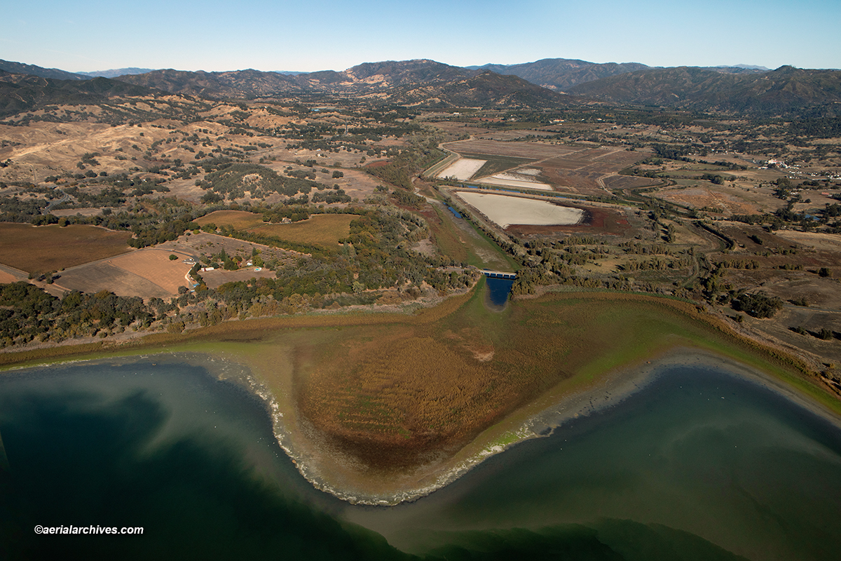
Image ID: AHLE1725
Rodman Slough is a wetland that drains into Clear Lake. It is fed by Scotts Creek and Middle Creek and is an important habitat for wildlife including fish, birds and amphibians. Rodman Slough is a remnant of a much larger wetland area drained for farmland that included Tule Lake, a seasonal lake that forms in the winter when Scotts Creek overflows. The slough is an important stopover point for migratory birds. It has a large rookery of great blue heron and is an important breeding and nursery area for black bass, catfish and black and white crappie.
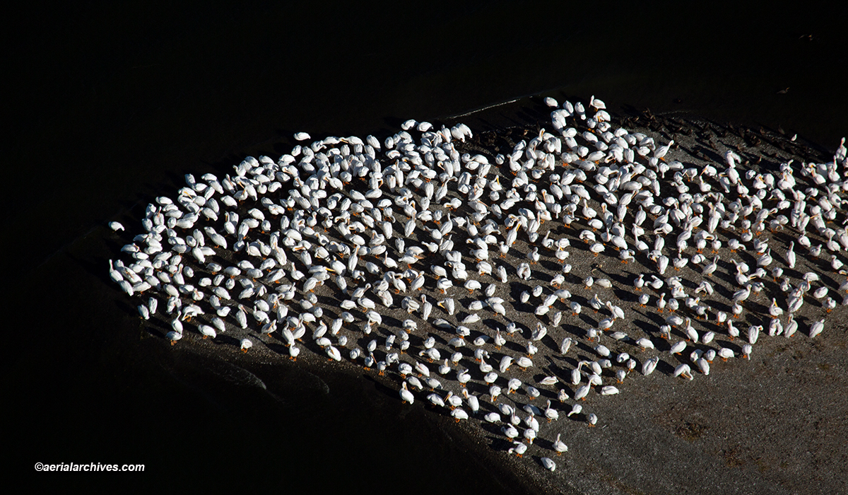
Image ID: AHLE1714
Hundreds of American White Pelicans spend the winter at Clear Lake. The flock shown above is located on a sandbar just outside of Clear Lake State Park. The white pelicans are particularly attracted to Clear Lake because it is a shallow lake making it easier for them to locate minnows than they could at adjacent bodies of water such as Lake Pillsbury or the Indian Valley Reservoir. Because Clear Lake is a shallow lake, the impacts on the Lake’s shoreline can be dramatic during droughts and floods.
Please use these links to view additional related photography:
Aerial Photographs of Lake County, California
Aerial Photographs of the Drought in the Western United States
Aerial Photographs of Wetlands
Photographs of the Drought at Clear Lake
