Aerial Photography of Napa Valley in the Spring
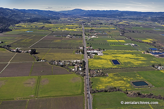
Image ID: AHLB4117
© Herb Lingl/aerialarchives.com
The yellow areas visible in this aerial photograph of Napa Valley are blooming mustard fields. Numerous vineyards in Napa Valley plant mustard. Mustard serves as a bio-fumigator that suppresses pests and diseases. It is also rich in nitrogen and has long been used as a cover crop.
The Oakville AVA is in the foreground of this aerial photograph. The AVA is known for its success with Bordeaux varietals. It extends from the Mayacamas mountains on the west to the Vaca mountains on the east. Over 50 wineries source their grapes from vineyards in the Oakville AVA. The AVA covers approximately 5000 acres of planted vineyards.
The tracks of the Napa Valley Wine train which run along highway 29 are visible in the photograph.
The Opus and Mondavi wineries are located slightly above the middle ground of the photograph. Trees growing along the Napa River show the course of the river beginning in the middle ground right of the photograph.
License this photograph or purchase a print.
More aerial photographs of the Napa Valley.
More aerial photography of vineyards.
More information about aerial photography of the Napa Valley.
