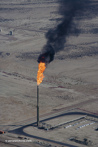
 This aerial photograph shows a flare stack burning natural gas in southern Wyoming. It illustrates the large amount of black carbon that can be released into the atmosphere by some flares.Flaring has increased significantly in the United States in recent years. According to the World Bank, flaring in the US increased 48% between 2017 and 2018. Fracking has resulted in the production of large amounts of natural gas along with oil production. With the oversupply of natural gas, some operators are flaring gas. A study published in Atmospheric Chemistry and Physics indicates that gas flares have contributed to over 40% of the black carbon deposited in the Arctic. Black carbon deposits contribute to the rates of snow and ice melt. Flaring also contributes substantially to the amount of CO2 emitted into the atmosphere and is an important contributor to global warming. Properly operated flares convert methane to CO2. Methane’s global warming impact is 34 times greater than that of CO2. Improperly operated flares may emit methane, sulfur dioxide and a variety of carcinogenic hydrocarbons. There are more natural gas flares in the United States at this time than any other portion of the globe. Both satellite imagery and aerial photography are useful tools to identify the location and density of natural gas flares.
Image ID: AHLB9621
© Herb Lingl/aerialarchives.com
License this photograph or purchase a print.
More aerial photographs of gas flares.
More aerial photography of the oil and gas industry.
Information about aerial photography of the oil and gas industry.
More aerial photographs of the Wyoming.
