Ice on the Hudson River
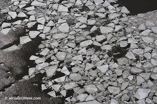
Image ID: AHLE01921
© Herb Lingl/aerialarchives.com
More aerial photography of New York City
License this photograph or purchase a print

More aerial photography of New York City
License this photograph or purchase a print

License this photograph or purchase a print.
More aerial photography of Super Bowl City in San Francisco during Super Bowl 50

Image ID: AHLV4420
© aerialarchives.com
Details about aerial maps and historical aerial photography of Imperial County
More aerial photographs of the Salton Sea and Imperial County, California

Image ID: AHLE0057
© Herb Lingl/aerialarchives.com
More aerial photographs of Manhattan in Winter
More aerial photographs of Manhattan
License this photograph or purchase a print


Image ID: AHLB4233
© Herb Lingl/aerialarchives.com
Purchase this book from Meadowlark Publishing’s web site
More aerial photographs of Lake County
License this photograph or purchase a print

License or purchase a print of this aerial photograph
More aerial photographs of Los Angeles California
Historical aerial photographs of Los Angeles
Pacific Design Center website

More information about the Sonoma County Crop Report
More aerial photographs of Sonoma County, California
More aerial photographs of vineyards

More aerial photographs of California’s Great America
More aerial photographs of Santa Clara, California
More aerial photographs of San Jose, California

More information about aerial photography of Louisville, Kentucky
Gallery of aerial photography of Louisville, Kentucky